It is March 2016 and we are again on a road trip!!!
It is exciting again... but I wondered, "Would additional years in our age, still make us (actually me!) flexible for less comfortable trip through the not so perfect National Highway in Western Mindanao and RoRo ... and eventually reaching our final destination in Bacolod City then back to Zamboanga City?"
It is Day 1 and we are expecting a five to six hour road trip from Zamboanga City to Ipil, Zamboanga Sibugay for our first stopover at Jollibee Ipil, then onwards through Zamboanga Del Norte to Dipolog City... 307 km. trip!
 |
| ROUTE MAP OF ZAMBOANGA CITY TO DIPOLOG CITY 307 KMS |
 |
| ROUTE MAP FROM ZAMBOANGA CITY TO FIRST STOPOVER: IPIL, ZAMBOANGA SIBUGAY (136 KMS) |

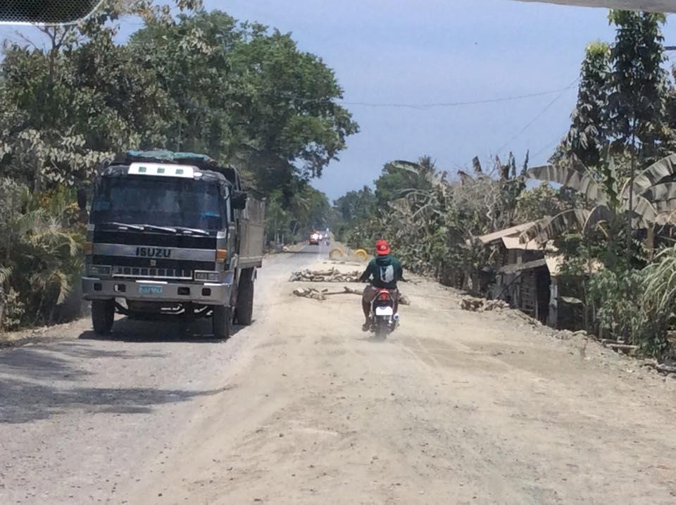
Vitali area


We already see the effects of El Nino as we travel through the countryside...

Although, there are few green areas still noted close to the predominantly brown fields.

Finally, we have arrived at Jollibee Ipil where we would have our early lunch and restroom stopover!
This is the safest place for a stopover because there aren't any larger restaurants for the next leg until we reach Dipolog City.


This is Jollibee Ipil. There are really lots of customers here this Sunday!

From Ipil, Zamboanga Sibugay, we are on our way again to Dipolog City, Zamboanga Del Norte which is another 174 kms away.
 |
| ROUTE MAP FROM FIRST STOPOVER AT IPIL, ZAMBOANGA SIBUGAY TO DIPOLOG CITY (174 KMS) |
This is the Ipil Rotonda or Round-about marking the historical chartering of Zamboanga Sibugay as a province.

Here were are on our way as we pass by the beautiful roads in Tampilisan, ZDN.

But there are not so good roads, too!

In fact, this is the so-called TRAFFIC FLAG! RED means STOP while GREEN means GO!
Some motorcycles, however, still GO even with the RED FLAG!

And here is more evidence of the El Nino Phenomenon!

And of course, interesting things catch our attention... like, KEEP DESTANCE!

And other modes of transportation running through the Philippine highways!

By the way, I am seeing less animals on the road. I used to see dogs, cats, chickens, goats, cows and horses traversing the highway. For this trip, I did see chickens, carabao and a horse, fortunately, more on the roadside.
As we crossed to Zamboanga Del Norte, we now see the beautiful and rustic seaside views.


Oh! And we now seen the Welcome Arch for Dipolog City!

It was a Sunday and the city streets were quiet as we looked for the Medallion Shipping Lines office to get our ticket for our next leg!


Then, we went to the 4 p.m. mass at the Holy Rosary Cathedral for Palm Sunday Mass.


We passed by Lee Plaza for an early dinner at Chow King!

We reached Chow King by 6 p.m. Our orders were a bit delayed, but, we had to hurry up or we will miss our 7 p.m. RORO (roll on roll off) ride to Cebu!
We immediately went towards the Dipolog City Port for our Boat Trip! We were just on time... and the last to board!

This is a 9-hour ship ride on board the Medallion Shipping, Our Lady of Good Voyage vessel. A new experience for me but the second time for my travel mates!
This is an easier ride to Cebu since we will dock directly at Pier 3, Cebu City.
We used to ride the vessel at the Dapitan Port to Dumaguete for four hours, then, another 38-minute ferry ride from Tampi-Bato Ferry (Dumaguete) to Santander, Cebu and a road trip again to Cebu City for a total of another 11 hours!
This is more difficult because you had to know the boat schedules for proper timing.
This is more difficult because you had to know the boat schedules for proper timing.
 |
| OLD ROUTE FROM DIPOLOG CITY TO DAPITAN TO DUMAGUETE TO CEBU |
With this route, it is 307 km plus 274 km = 578 kms from Zamboanga City to Cebu City.
For our drivers, the new Dipolog City to Cebu City nautical highway is definitely a breeze!
We still have a long way to go for the completion of our trip to Cebu-San Carlos City-Bacolod City and back!
For our drivers, the new Dipolog City to Cebu City nautical highway is definitely a breeze!
We still have a long way to go for the completion of our trip to Cebu-San Carlos City-Bacolod City and back!
No comments:
Post a Comment